Vicarage Fields

The Vicarage Fields lie to the north-west of the Priory Church, on land sloping down to the River Lune. Roman remains lie undisturbed under what was glebe land during the Middle Ages. The River Lune and the Carlisle Bridge carrying the West Coast main line can be seen in the background of this picture. The original wooden bridge of 1846 was rebuilt in steel in 1866. Carlisle Bridge was rebuilt again in 1962-63; the original stone piers were retained.
Part way down Vicarage Lane turn right, following the sign for the Roman bath house.
Bath House and Wery Wall
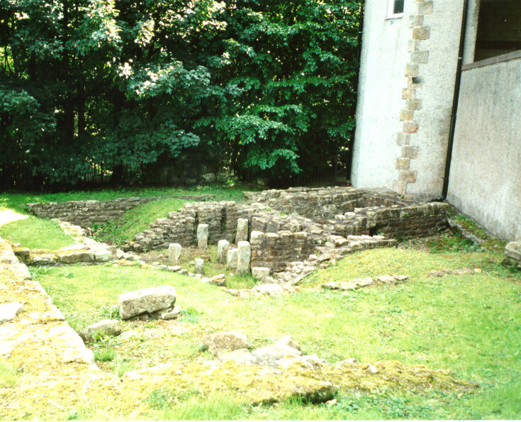
These are the only visible, in-situ remains of Roman Lancaster.

This small bath house was attached to a large courtyard building lying outside the fort on its north side. This building may have been the residence of an important official or a mansio - a kind of hotel for those on official business. The courtyard building and bath house date from mid-late 2nd century AD/CE.
In the 4th century AD/CE the Roman fort at Lancaster was rebuilt on a new alignment. This was heavily defended, in the manner of the Saxon shore forts of the south and east of England, and was surrounded by a massive wall, nine feet thick. This wall survived for centuries and became known as the Wery Wall. Only a small fragment survives today. The surviving fragment represents the core of an artillery mounting at the northern corner of this late fort. The photograph shows where the ditch associated with the new fort cut through the bath house of the courtyard building. The fragment of the Wery wall can just be seen under the trees in the background.
Return to Vicarage Lane, turn right and continue downhill to the river and St. George's Quay.


 Next
Next